



Express tunnel car wash – Beloit
1405 Cranston Rd, Beloit, WI
View on Google Maps
$635,000
Highlights
- Membership program in place
- 3 vacant bays for self-serve conversion
Property facts
| Asking price | $635,000 |
|---|---|
| Wash type | Express |
| Deal type | Includes real estate |
| Address | 1405 Cranston Rd, Beloit, WI |
| Lot size | 0.9 acres |
| Building | 4,420 SF |
| Date listed | 2026-08-06 |
| Days on market |
About this car wash
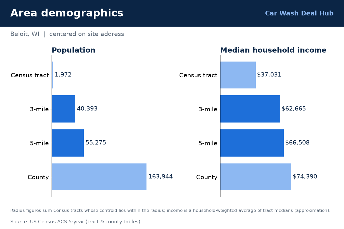
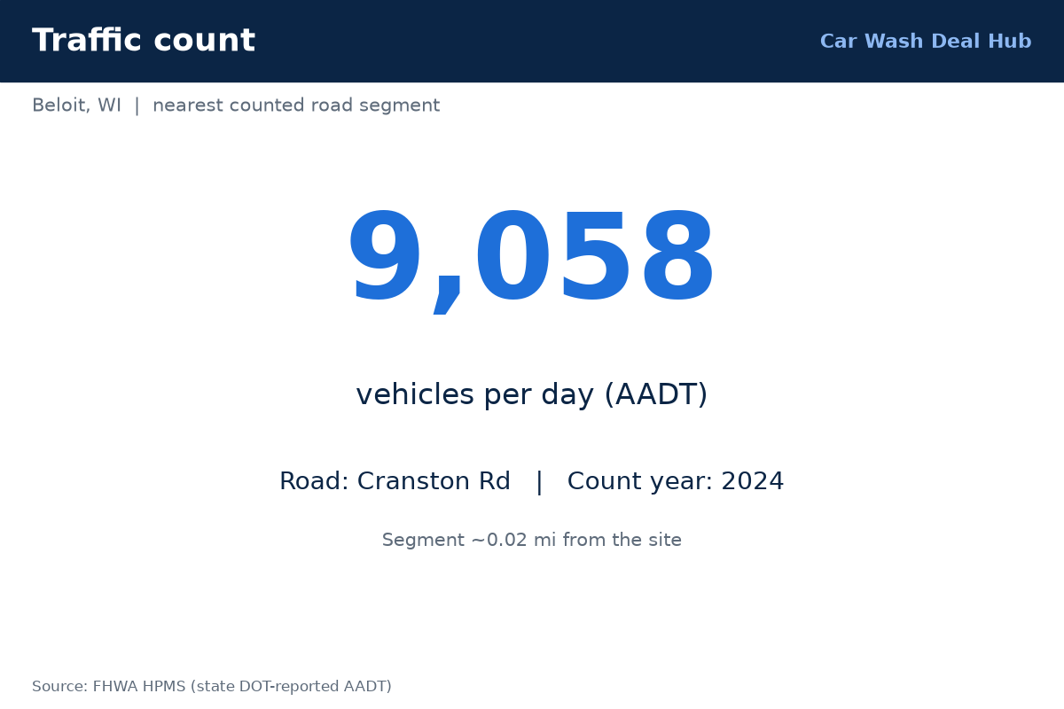
Beloit, WI offers an 80-foot express tunnel with a membership program already in place, plus three vacant bays that could be converted to self-serve. The property at 1405 Cranston Rd covers about 0.9 acres with a 4,420-square-foot building, and the land and building appear to come with the sale at $635,000. About 9,100 vehicles/day pass on the nearest counted road (2024), and roughly 40,400 residents live within three miles, with a median household income near $62,700. Public mapping shows at least five other washes nearby. Request info for financials and offering details.
Financials
Financials available on request.
Traffic
| Vehicles per day (VPD) | 9,058 (2024) |
|---|---|
| Where | Road adjacent to the site |
| Source | FHWA HPMS |
Demographics
| 3-mile radius (approx.) | 40,393 people · 15,026 households · median household income ~$62,665 |
|---|---|
| 5-mile radius (approx.) | 55,275 people · 21,137 households · median household income ~$66,508 |
Data: U.S. Census ACS 5-year (via Esri Living Atlas); FHWA HPMS traffic counts; © OpenStreetMap contributors; imagery USGS The National Map / USDA NAIP (public domain). Figures are approximate.