


Express tunnel car wash – Phoenix (0.92 ac; 6,000 SF)
16843 N 43rd Ave, Phoenix, AZ
View on Google Maps
$3,300,000
Highlights
- Built 2018
- Sonny's equipment
- 21 vacuums
- ~640 members
Property facts
| Asking price | $3,300,000 |
|---|---|
| Wash type | Express |
| Deal type | Includes real estate |
| Address | 16843 N 43rd Ave, Phoenix, AZ |
| Lot size | 0.92 acres |
| Building | 6,000 SF |
| Year built | 2018 |
| Vacuums | 21 |
| Equipment | Sonny's equipment |
About this car wash
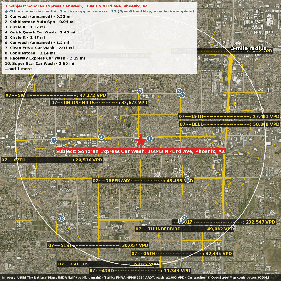
Roughly 640 members are already on the books at this 2018-built express tunnel in North Phoenix, which runs Sonny's equipment and offers 21 vacuums. The site at 16843 N 43rd Ave covers about 0.92 acres with a 6,000-square-foot building, and the land and building appear to be part of the sale at $3.3M. The nearest counted road sees about 23,000 vehicles/day (2024), and more than 142,000 people live within three miles, with a median household income near $75,400. Mapping shows at least 14 other washes in that radius, so this is an established, competitive market. Request info for the financials and full package.
Financials
Financials available on request.
Traffic
| Vehicles per day (VPD) | 23,078 (2024) |
|---|---|
| Where | Road adjacent to the site |
| Source | FHWA HPMS |
Demographics
| 3-mile radius (approx.) | 142,347 people · 54,988 households · median household income ~$75,359 |
|---|---|
| 5-mile radius (approx.) | 228,451 people · 87,814 households · median household income ~$77,568 |
Data: U.S. Census ACS 5-year (via Esri Living Atlas); FHWA HPMS traffic counts; © OpenStreetMap contributors; imagery USGS The National Map / USDA NAIP (public domain). Figures are approximate.